In 1962..........
East Greenland -- closer to the action than one might think?
One might think that East Greenland in 1962 was a very long way from the "hot spots" of world politics. Not a bit of it. Keflavik Air Base in Iceland was fully operational, and was manned by the United States air force under an agreement with the Icelandic Government. Soviet "sealers" were often reported in the North Atlantic, and it was common knowledge that they had nothing much to do with sealing. there were NATO bases in west Greenland and on the ice sheet. This is what one of the characters in the story, Peregrin Whiteside, has to say:
"The Americans have hundreds of people working on future warfare planning -- futurologists, think tanks and scientists all beavering away, trying to work out what’ll be going on in ten or twenty years’ time. We probably have secret units in Britain too, doing the same sorts of things. I’ve heard of the Snow, Ice and Permafrost Research Establishment -- I was on a climbing expedition once with a fellow who worked on SIPRE projects. We were stuck in a bivouac for 2 days and passed the time by talking a lot. The real reason for SIPRE is to increase the capacity of the American military to operate in very hostile environments in the Arctic. That’s why they have Camp Century and Summit Camp and also a presence at Station Nord — to the irritation of the Danes. Everything is tested to destruction at those places where temperatures go down to -50 degrees C -- aircraft landing gear, living quarters, tracked vehicles and sledges, cold weather fuel, rocket propulsion, radar installations and so forth. Camp Century even has a nuclear reactor. You aren’t supposed to know that.................. "North Greenland is perfectly placed for long-range missiles, either coming from Russia or heading that way. Alaska’s a long way from Moscow. Kennedy is just as paranoid as his predecessors, and I wouldn’t mind betting that there are early warning installations up and running in North Greenland, and even long-range missile launch pads. There’s something strange going on up at Station Nord, right on the northern tip of Greenland. That’s only about 500 miles from the North Pole, and almost 800 miles away from the big American base at Thule. Keflavik in Iceland and Blyhavn in Greenland are key parts of the communications network if the weather shuts off the west side of the ice sheet..........." Now here's a funny thing. When I was digging around for information which I needed to give the novel authenticity, I suddenly came across a declassified US document called "Technical Report EP-140. Environment of Southeast Greenland" and published originally by the Quartermaster Research and Engineering Center, Environmental Protection Research Division" in October 1961. Unclassified Catalog number AD 251 797. It was incredibly detailed and had been written by a geographer named Andrew D Hastings -- clearly with a great deal of assistance. Although many pages are virtually illegible in the digitised version, there is enough detail visible to show that the East Greenland coast, adjacent to Denmark Strait, was being taken very seriously by the US military, and that vthey wanted to know EVERYTHING about it, including weather and climate, tides, sea ice conditions, landing beaches, anchorages, routes onto the ice sheet, vegetation, marine life etc etc. Almost spooky.......... And here's another funny thing. While we were in the field in 1962 there were two other geomorphologists working in the area -- well-funded, with helicopter support. we never did work out whether they were doing serious research -- but we got to know that they were working under the auspices of the US Army. And every now and then we saw a heard heavy military aircraft high overhead, heading north........ The hunt for riches
During our visit to Greenland in 1962 it was obvious that the Danish Government was working hard to discover what mineral riches there might be around the coasts of Greenland. A lot of geological mapping and prospecting work was going on in Scoresby Land and Jameson Land, involving both government geologists and teams paid for by mining companies. The expeditions organized by Lauge Koch laid much of the groundwork. They covered a vast area and produced many maps and specialist reports. They also left traces all over the fjord country -- camp sites, food caches, and huts used by the mineral prospectors and support parties. Ships, planes and helicopters were used. Svend Wurm, our Danish expedition member, had spent several seasons working with mineral prospecting teams, and so had Jimmy Cruickshank, our Geography lecturer from Queens University Belfast.
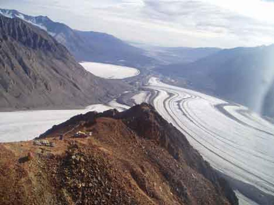
Malmbjerg is a 1750 m. high mountain located between the Schuchert and Arcturus Glaciers in the Werner Mountains. It hosts a rift- related porphyry-molybdenum deposit discovered in 1954 during systematic mapping of the Werner Bjerge complex by members of the Danish East Greenland Expeditions. Investigations in 1955 – 61 by the Danish mining company Nordisk Mineselskab A/S, and in 1962 by a Nordisk Mineselskab- AMAX Inc. joint venture, included excavation of three adits totalling 1329 m, from where 146 holes were drilled some 22,000 m. A big ore body was found. However, with a price at that time of US$ 1.6/lb MoO3, mining was not economically feasible. When we visited the mine in 1962, there was quite a bit of exploration activity at Malmbjerget, and caterpillar trains were using the passes through the mountains in order to get out to the coast near Mestersvig. They were bringing in supplies and mining equipment, and taking out rock samples. On a clear day , one could see the mountains on the south side of the Scoresbysund Fjord , almost 200 kilometres away. The story of Mestersvig began when Lauge Koch discovered occurrences of lead in the mountains . After years of preliminary studies , a permanent “town” was founded in 1952 and full-scale mining operations were commenced in 1955 . In connection with this , it was necessary to establish a runway capable of taking large aircraft, and this is how the airport of Mestersvig was founded . Furthermore , a harbour was needed for bringing in supplies and exporting milled ore -- and so Nyhavn (the “New Harbour”) was built . There are many photos of the mining operations and piles of milled ore on the shore waiting for export. The Mine Town was fully occupied until 1962, but in 1963 it was shut down when ore prices slumped . The molybdenum resource at Malmbjerget , which is very large , was so difficult to access that it was never fully exploited. To take crushed ore out it would be necessary to build a tunnel through many kilometres of mountain and glacier , and the shipping season was very short anyway. But in the 52 years that have passed, there have been several renewed phases of exploration and several plans have been put in place for opening a full-blown mine at Malmbjerget; but again and again, low world prices for the prime product have prevented major investments from taking place. Some might argue that that is no bad thing.............. |
The Cold War
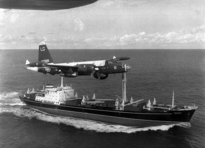
During the Cold War of 1947 and 1991 relations between the superpowers of USSR and USA were very tense indeed, and everybody who was alive at that time remembers the constant fear of a nuclear holocaust, which could have been triggered by a simple mistake or a diplomatic misunderstanding during the ongoing nuclear arms race. the term "Cold War" is used because there was no blatant conflict between the two sides -- the Warsaw Pact countries standing with the USSR and NATO standing with the USA. But there were plenty of regional conflicts within which there was major interference by the superpowers, especially in Korea, Vietnam and Afghanistan.
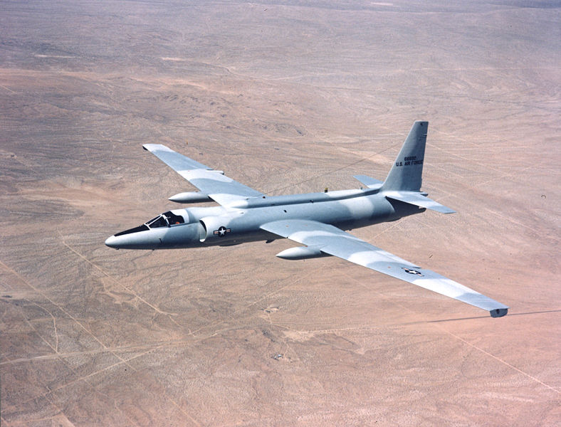
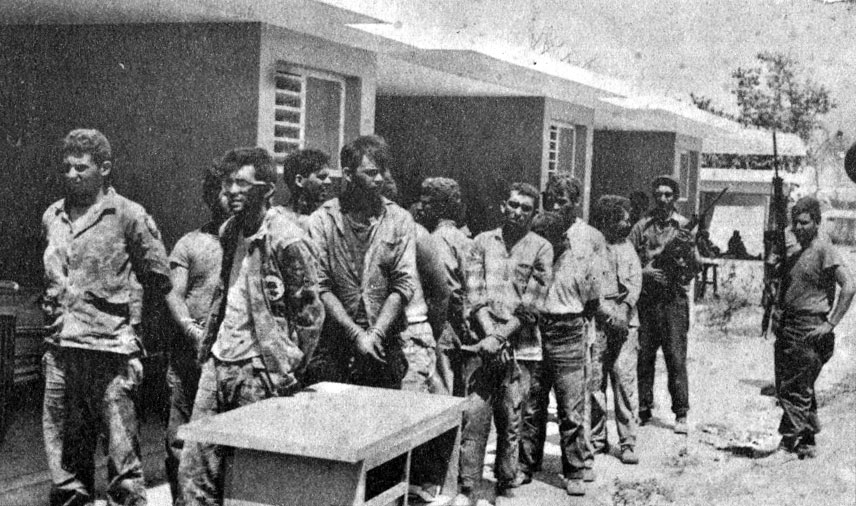
Here are a few pointers from Wikipedia. Two years before the heroes of "Acts of God" went off to East Greenland, an American U2 spy plane piloted by Gary Powers was shot down while flying over USSR air space. Initially the United States government tried to cover up the plane's purpose and mission, but it was forced to admit its military nature when the Soviet government came forward with the U-2's intact remains and captured pilot as well as photos of military bases in Russia taken by the aircraft. The incident was a great embarrassment to the United States and prompted a marked deterioration in its relations with the Soviet Union. Powers was convicted of espionage and sentenced to three years of imprisonment plus seven years of hard labor but was released two years later on 10 February 1962 during a prisoner exchange. In April 1961 Yuri Gagarin became the first man in space when he orbited the earth in the Soviet spacecraft Vostok. That was a severe embarrassment to the Americans, since they had assumed that they were well ahead in the "space race." In 1961 and 1962 they redoubled their attempts to push forward the space programme, and huge funds were committed to it. Just over a year before the period covered in "Acts of God", the Americans had been humiliated during the "Bay of Pigs" fiasco. Over 1,400 paramilitaries, divided into five infantry battalions and one paratrooper battalion, assembled in Guatemala before setting out for Cuba by boat on 13 April 1961. On 15 April, eight CIA-supplied B-26 bombers attacked Cuban air fields and returned to the U.S. On the night of 16 April, the main invasion landed at a beach in the Bay of Pigs. It initially overwhelmed a local revolutionary militia. The Cuban Army's counter-offensive was led by Captain José Ramón Fernández, before Castro decided to take personal control of the operation. On 20 April, the invaders finally surrendered, with the majority of troops being publicly interrogated and then sent back to the U.S. The failed invasion strengthened the position of Castro's administration, who proceeded to openly proclaim their intention to adopt socialism and strengthen ties with the Soviet Union. This led eventually to the events of the Cuban Missile Crisis of 1962. The invasion was a major embarrassment for U.S. foreign policy. John Kennedy ordered a number of internal investigations across Latin America. In 1962 the Berlin Wall was under construction -- and this fact did a great deal to deepen the deep freeze of the Cold War. From Wikipedia: The Berlin Wall was officially referred to as the "Anti-Fascist Protection Rampart" by GDR authorities, implying that neighbouring West Germany had not been fully de-Nazified. The West Berlin city government sometimes referred to it as the "Wall of Shame"—a term coined by mayor Willy Brandt—while condemning the Wall's restriction on freedom of movement. Along with the separate and much longer Inner German border (IGB), which demarcated the border between East and West Germany, it came to symbolize the "Iron Curtain" that separated Western Europe and the Eastern Bloc during the Cold War. Below: some Cold War images The top of the "ore mountain" at Malmbjerget -- called Himmelbjerg in the novel
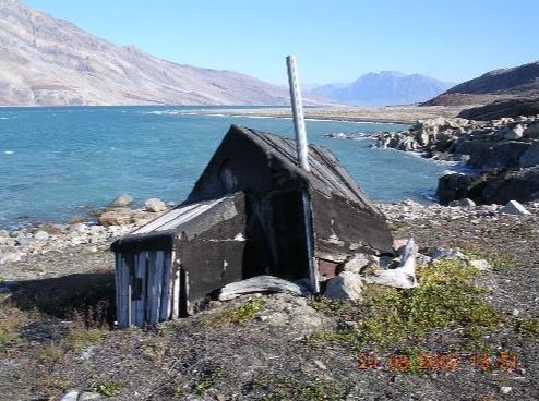
A typical small fjordside hut in East Greenland -- built either by trappers, Sledge Patrol members, or geological exploration parties.
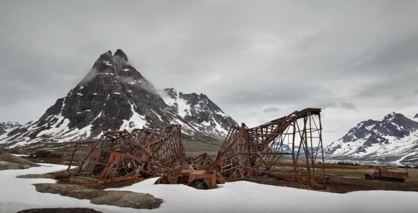
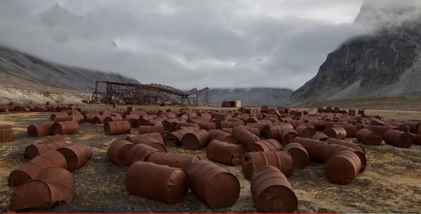
Some of the debris from the American Cold War occupation of north Greenland. They just walked away and left it all where it was........
|
