The East Greenland Fjords
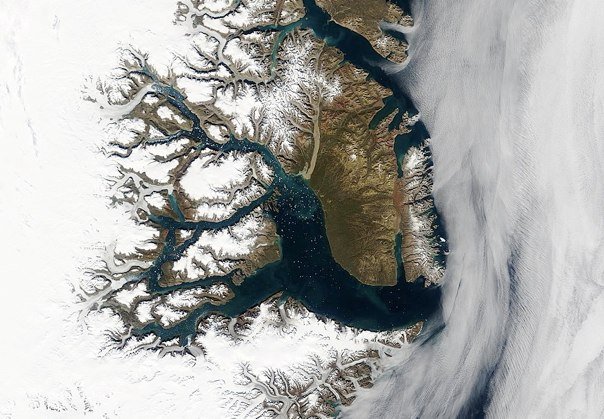
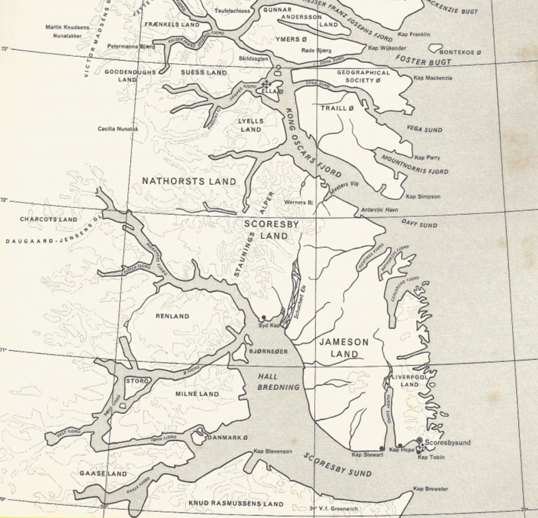
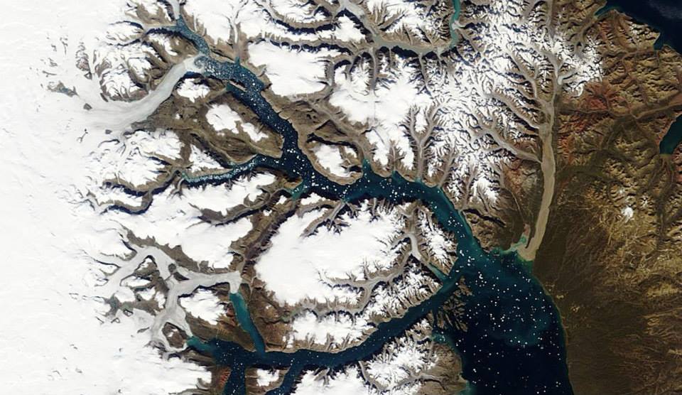
As shown in the above satellite image and map, the East Greenland Fjord landscape is one of the most spectacular in the world.
The fjords stretch for hundreds of kilometres along the east coast, having been carved out of the landscape over millions of years by vast glaciers draining the Greenland Ice Sheet. The pattern of glacier flow has been by no means simple -- we see not just troughts carved out on the most direct routes to the coast, but highly complicated "rectilinear" patterns, with many connecting or cross-fjords running in unexpected directions. For about ten months of the year the fjords are choked with sea ice, and the only effective means of travel is by dog sled or (nowadays) by skidoos. In addition to the sea ice, vast numbers of icebergs move inexorably out towards the coast, having been calved off the big glaciers that still drain the ice sheet. Nordvest Fjord is really the mother and father of all the fjords on Planet Earth. If you go to any of the fjord sites on the web, you will find copious amounts of information about Sognefjord, Milford Sound, the fjords of Chile and even Antarctica, but very little about this one. Strange, given that it is now well known from satellite imagery, even if not very frequently visited. That's because access is very difficult. The fjord extends c 217 miles (350 km) inland from the outer coast. It's in two sections -- the outer (very broad) part is called Scoresby Sund, which is about 20 miles wide and 120 miles long, with Jameson land to the north and Milne Land and Knud Rasmussens land to the south and west, and then Nordvest Fjord proper, which pushes inland for a further 95 miles or so. In this section the fjord is mostly less than 5 miles wide, and in places as narrow as 3.5 miles from shore to shore. Access into the fjord system is often very difficult, even for ice-strengthened ships in the summer, because of the thick pack ice which congests the Scoresby Sund entrance; in some years no vessels manage to get through it, and even when access is possible, the fjord is effectively shut off again early in September. The Nordvest Fjord - Scoresby Sund system has clearly been one of the major outlet routes for ice from the Greenland Ice Sheet, during the whole of the Pleistocene and maybe for much longer than that. Even today the Daugaard Jensens Gletscher, near the head of the fjord, is possibly the most productive glacier in the whole of Greenland. Because the ice here has been streaming so effectively in a narrow and constrained trough, the rate of downcutting has been impressive indeed. There are no proper bathymetric charts, but from the scattered soundings that have been made we see depths of 1372m, 1459m, 1372m, 1150m, 1237m, and 1290m between Eskimo Bugt and Syd Kap. The deepest sounding of all is 1508m (4,947 ft). These soundings show that the fjord is substantially deeper than Sognefjord in Norway (maximum known depth 1308m), which has just one short stretch deeper than 1200m. But here on the flanks of Nordvest Fjord the plateau ice caps and mountain summits are almost all over 2000m (6561 ft), whereas there is little land over 1600m on the flanks of Sognefjord. So the full depth of Nordvest Fjord over a distance of about 80 miles is approx 3300m or 11,000 feet. I'll let somebody else work out how much material has been eroded and removed by ice from a trough of this size....... but it is indisputable that this is the deepest, longest and most dramatic fjord system on earth. We don't know enough about the long profile to know whether it conforms to the "ideal" long profile of Sognefjord, where we can see an incremental deepening of the trough wherever there have been supplements to the ice discharge via tributary glaciers. I would expect something similar in the case of Nordvest Fjord. What we do know is that where the narrow Nordvest Fjord opens out in the vicinity of Syd Kap and the Bear Islands, there is a sudden shallowing of the water, as the bedrock floor rises to approx 400-500m below sea level. This is very similar to the situation at the mouth of Sognefjord, where ice diffluence has been associated with a reduction in erosive capacity, as we can see on the diagram above. We don't exactly see skerries at the junction between the deep fjord and the shallow fjord, but there are some grounds and small islets which make navigation difficult and dangerous, and as in the case of Sognefjord the fjord bed rises from c 1200m to just a few tens of metres over a distance of just 4 miles. This is called the threshold, and it explains why there is relatively little water exchange in the murky depths of the fjord; vast quantities of water are simply trapped in what is in effect a gigantic elongated basin. The men who know this area best belong to the legendary Sledge Patrol, whose role in the Second World War is recorded in David Howarth's splendid book called -- unsurprisingly -- "The Sledge Patrol"...............
There is a long history of exploration in this region. Here is Tony Higgins's brief history of the main phases of exploration:
Nanu Travel is one of the main tourist companies in Greenland, with a highly informative web site.
About the East Greenland National Park, one of the most remote protected areas in the world:
|
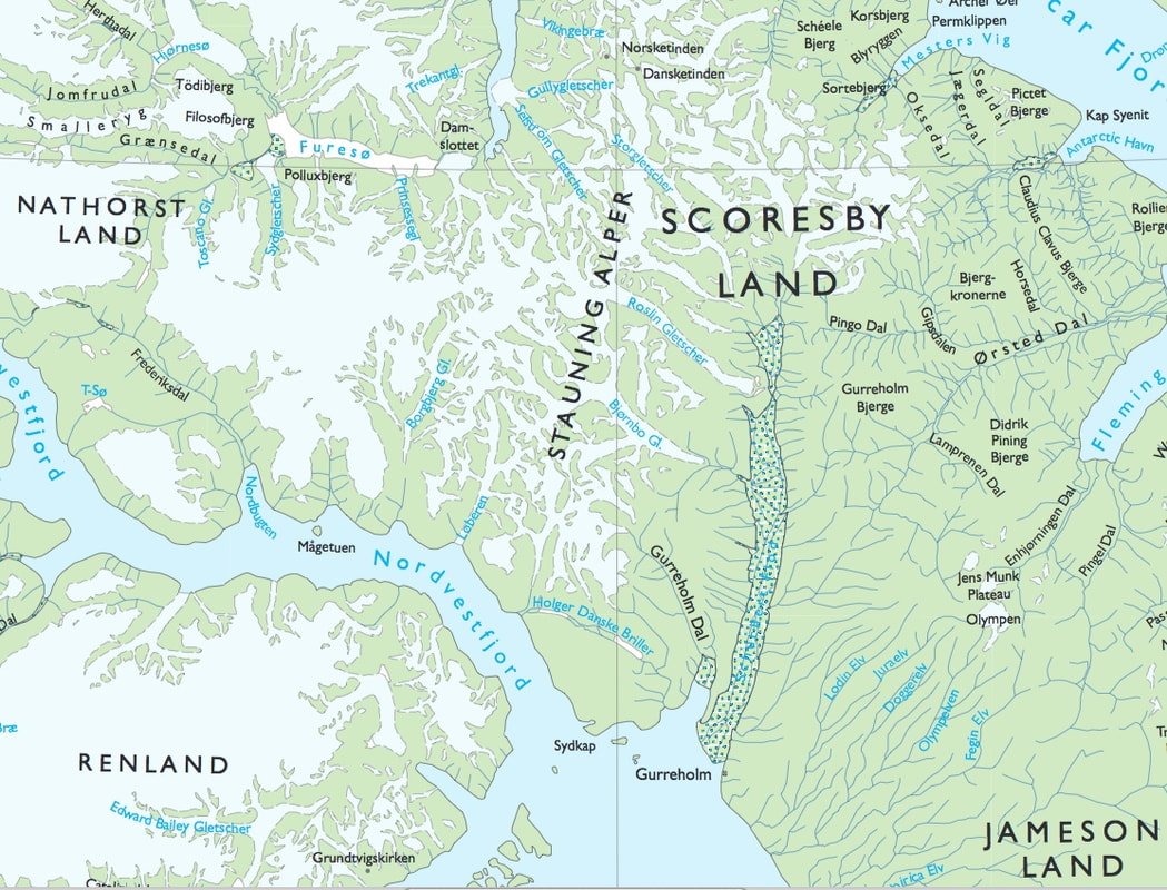
Extract from the official Danish map of the area where all the action takes place.
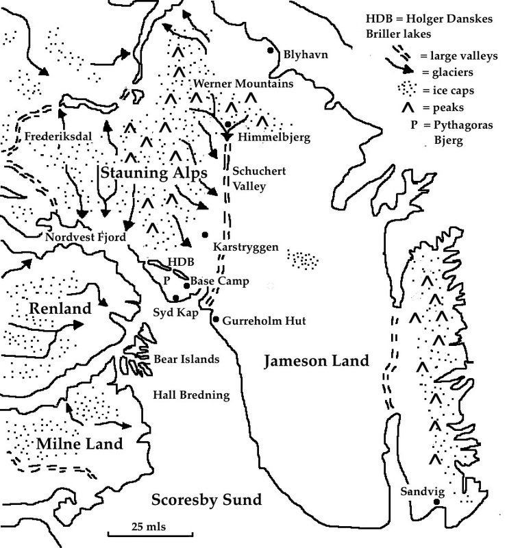
This simplified sketch map shows some of the key features of the terrain and covers the "theatre of action" of the story. Most of the place names shown are real -- and indeed it has been my intention to set the story in a real geographical location rather than in an imagined landscape -- but three of the big locations in the story (Blyhavn, Himmelbjerg and Sandvig) are invented names.
The fjord landscape in the inner reaches of the Scoresby Sund region
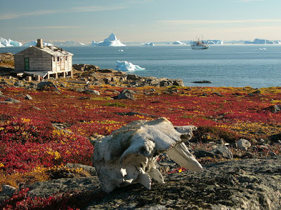
Syd Kap (South Cape) in its autumn colours. This is one of the key locations in the story
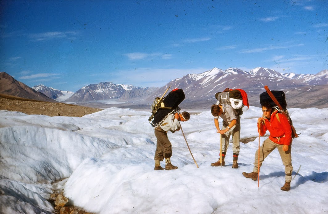
In 1962 three of the members of the OU Expedition to East Greenland rest on the surface of Roslin Gletscher (that's me in the middle)
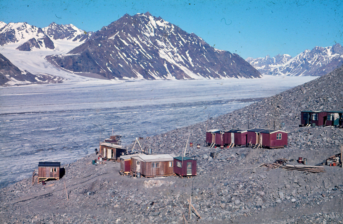
Another key location in the story. The remote mining settlement of Malmbjerget has been turned, in the story, into Himmelbjerg (the mountain of heaven), where assorted dodgy things are going on.......
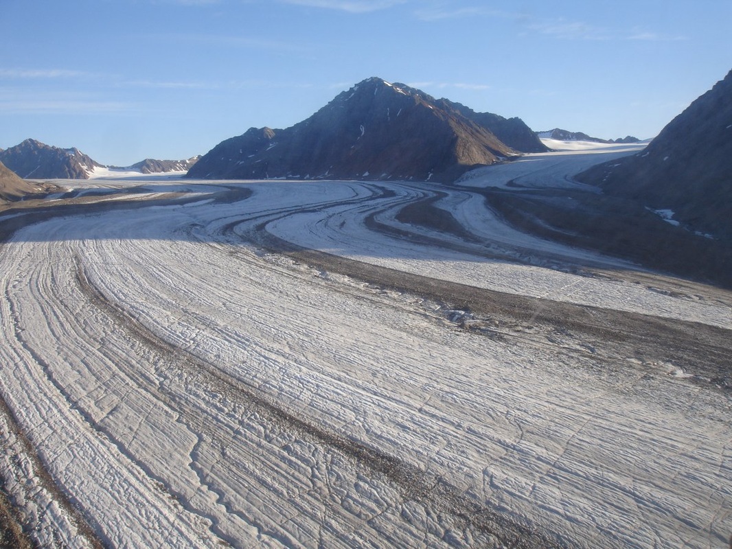
A great photo from Ruth Mottram, showing Malmbjerget and its flanking glaciers in 2008
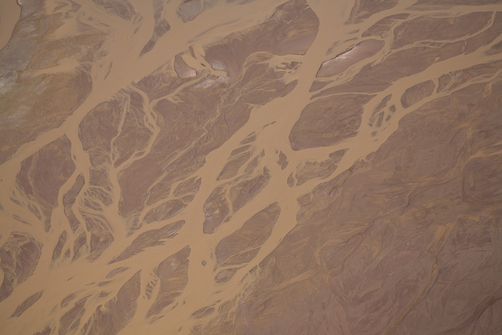
The braided river called Schuchert Flod. It fills the Schuchert valley and is the biggest and longest river in Greenland, carrying the meltwater from eleven glaciers. Don't even think about trying to cross it except in winter.........
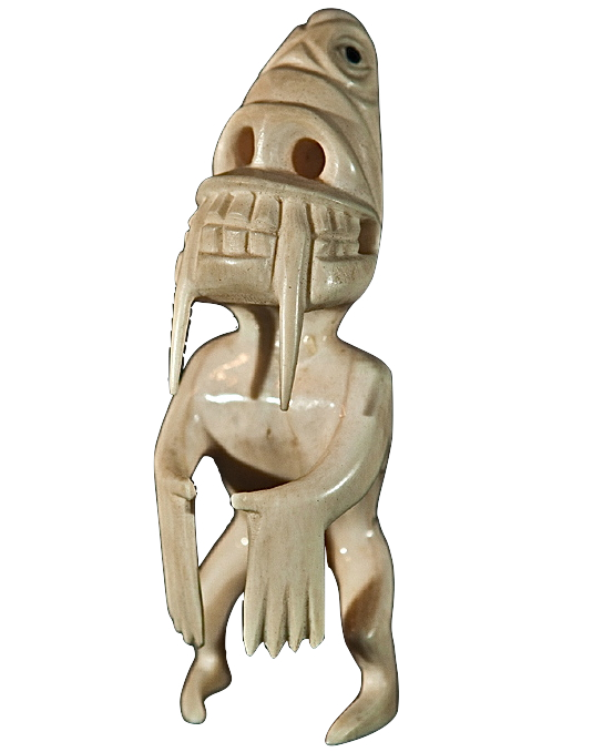
Below: the tupilaq or tupilak is a grotesque creature, up to about 10 cms tall, usually carved from ivory by an Inuit shaman as part of a ritual. Sometimes a tupilak would be carved in order to place a curse on an enemy, and it would have very powerful magic associated with it............
|
